
Elevation
400m-1200m
Difficulty
🟦 → 🖤
Season
Year-round
Semnoz is the most accessible riding area in the Annecy region, rising directly above the southern edge of town. You can reach the trailhead by bike from the city centre in under 20 minutes, making it the obvious first stop for anyone who wants to ride without driving.
Trail elevation
Not every ride on the Semnoz requires a big day out. Shorter loops with as little as 400 metres of elevation are available, which makes it a practical option after work or when the weather window is short. For those who want more, the plateau tops out above 1,700 metres with views across the lake and into the Mont Blanc massif.
Trail difficulty
The trail network covers a wide range of terrain and difficulty, from flowing blue singletracks to demanding black runs. That range makes it genuinely useful for groups of mixed ability, and for riders who want to progress over multiple visits.
Riding season
The lower elevation trails near Annecy are rideable year-round and dry out quickly after rain. Rides above 1000m are usually snow-free from April to November.
Trail Map
Semnoz Tips
Parking
There is parking at the Basilica as well as the Les Puisots picnic area on Semnoz.
Water and Toilets
The Les Puisots picnic area has both drinking water and toilets, which are usually open.
There are also toilets and drinking water at the top of Semnoz, near the bottom of the ski station. They may not be accessible if the lifts are closed.
Bus to the Top of Semnoz
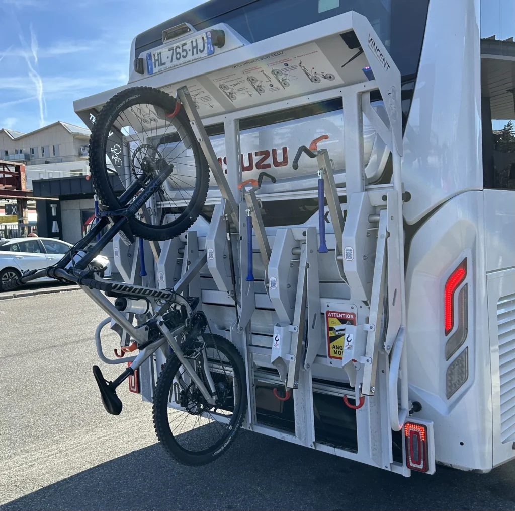
Everyday in July and August, there is a public bus, the S4 line, that runs from downtown Annecy to the top of Semnoz.
The bus has a bike rack at the rear, making it easy to bring your mountain bike on the bus up and enjoy the bike park at the top, then descend the 1200m back to town.
The cost of the bus is a regular €2 bus ticket, plus a supplemental €6 charge to bring a bike. Tickets cannot be purchased from the driver, so must be purchased ahead of time at the Sibra Office.
The best place to take the bus is at the main station. The rack can handle bikes up to 30kg and uses a piston to assist in lifting the front wheel up. There’s space to add a cable lock for extra security, although Annecy in general is very safe.
Semnoz Bike Park
Semnoz has a ski station at the summit which in July and August, becomes a small bike park. There are 3.5 trails which descend 220m: two reds, one blue, and half of a green track.
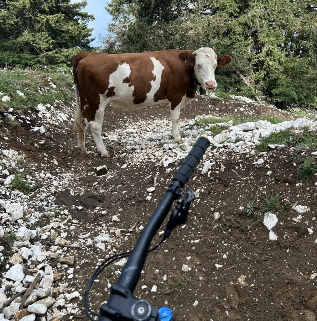
The trails share the space with an alpage, so there are frequently cows, poop, and fencing on the tracks.
Semnoz Recommended Routes
Small Semnoz Ride 🟦 / 🔺
This route starts in Annecy and climbs on the road to the Basilica and trailhead.
From the trailhead, this route climbs the western side of Semnoz on Sentier de sous les Becs and the western crest trail. It crosses over to the eastern side of Semnoz at Les Puisots parking area.
The descent begins from Les Puisots and runs along the eastern side of Semnoz, mainly on the crest trail. The trails end across from the lake.
Medium Semnoz Ride 🟦 / 🔺
This route starts in Annecy and climbs on the road to the Basilica and trailhead.
From the trailhead, this route climbs the western side of Semnoz on Sentier de sous les Becs and Chemin des Puisots, with a stop at Les Puisots. From there, it parallels the D41 road until arriving at the trails above Quintal.
The descent starts on the red and blue tracks above Quintal, which can easily be lapped. It then descends along the eastern side of Semnoz, before crossing over to the western crest trail and descending to the lake.